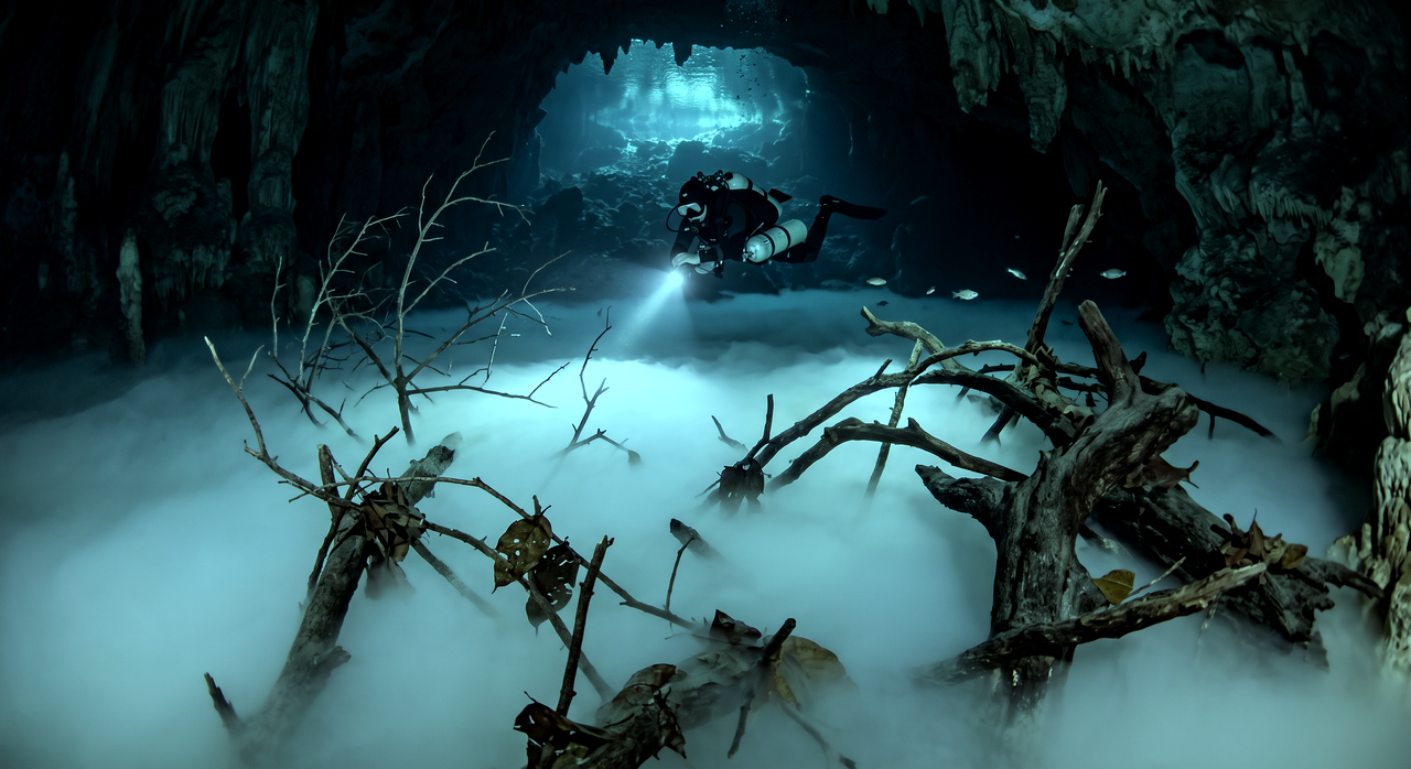
Cenote Angelita
Overview
Cenote Angelita is one of the most surreal dive sites on the planet, famous for its breathtaking 'underwater river' — a thick, clearly defined layer of hydrogen sulfide gas that hovers at approximately 30 meters depth, so dense and well-formed that it genuinely appears to be a river flowing beneath the water's surface. Dead tree trunks and branches protrude from this misty layer like a submerged forest, creating scenes that look more like fantasy art than reality. The cenote is a near-perfect circular sinkhole in the jungle south of Tulum, its surface surrounded by dense tropical vegetation. The dive begins with a descent through clear fresh water, past the halocline where fresh and salt water create their characteristic shimmer. As divers approach 28 meters, the hydrogen sulfide cloud comes into view — a thick, swirling mist that fills the entire cenote. The effect is mesmerizing: the cloud has clearly defined 'banks' where it meets the cenote walls, and decomposing trees and branches create the illusion of a riverbank landscape frozen beneath the water. Cenote Angelita is strictly for experienced deep divers, with most operators requiring Advanced Open Water certification and documented deep diving experience. The cenote bottom reaches beyond 60 meters, well into technical diving territory, but the most impressive features are visible between 28 and 35 meters — achievable within recreational limits for properly trained divers. The site has become an icon of Mexican cenote diving and a bucket-list destination for underwater photographers seeking images that challenge the viewer's perception of what is possible underwater.
Early access
Plan a dive here
Open the DiveOne planner to sketch a recreational plan before you go. It is a planning assistant, not a dive computer.
Marine life
Dive profile
DEPTH PROFILE
DEPTH PROGRESSION & WAYPOINTS: Cenote Angelita
Location
Frequently asked questions
What is the underwater river?
It is a thick layer of hydrogen sulfide that sits at around 30 meters, so dense and defined that it looks like a flowing river complete with banks and islands of dead vegetation.
How deep do I need to go?
The 'river' effect begins at about 30 meters. While the cenote goes to 60m+, the most impressive part is between 28-35 meters. Deep/Advanced certification is required.
Is it dangerous?
The hydrogen sulfide is mildly toxic in high concentrations but passing through the thin layer briefly is not harmful. The main risk is depth-related — proper training and gas management are essential.
Reviews
Reviews
No reviews yet
Data Provenance
This profile is compiled from 3 operator submissions and 142 community logs. Key facts (depth, entry) are verified against official hydrographic charts.