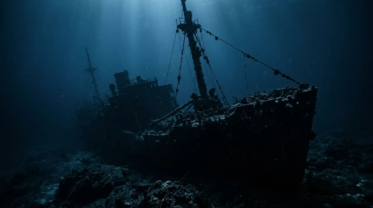
SS Umbria Wreck
Overview
The SS Umbria is widely regarded as one of the finest wreck dives in the world, lying on her port side at Wingate Reef just outside Port Sudan in the Sudanese Red Sea. Built in Hamburg in 1912 as a cargo and passenger vessel, the 150-metre ship had a turbulent history that culminated on June 9, 1940, when her Italian captain chose to scuttle her rather than surrender a cargo of 360,000 bombs to the British navy at the outbreak of World War II. The wreck rests at an angle of approximately 75 degrees, with the shallowest point at just five metres and the bow reaching 38 metres at its deepest. This wide depth range makes the Umbria accessible across multiple dives and skill levels. The upper sections of the hull, bridge, and deck structures sit between 15 and 20 metres, draped in vibrant soft corals, sponges, and sea fans that have transformed the wartime vessel into a living reef. Schools of batfish hang motionless near the funnel, lionfish occupy every shadowed corner, and large groupers have taken up permanent residence in the cargo holds. The most haunting aspect of the SS Umbria is her cargo. Peering into the holds, divers can see rows upon rows of bombs, Fiat truck chassis, wine bottles, and other supplies perfectly preserved in the clear Red Sea water. The combination of historical significance and marine colonization creates a dive experience that engages the imagination as much as the senses. Swimming through the engine room, past coral-encrusted davits and cargo cranes, the scale and atmosphere of the wreck are unforgettable. Visibility at Wingate Reef is typically excellent, ranging from 20 to 30 metres, and the sheltered location provides protection from strong currents. Water temperatures range from 24 degrees Celsius in winter to 30 degrees in summer. Most divers visit the Umbria as part of a Sudanese liveaboard itinerary, combining it with other world-class Red Sea sites. The remoteness of Sudan's diving scene means encounters with other dive groups are rare, preserving the sense of discovery that makes this wreck truly special.
Early access
Plan a dive here
Open the DiveOne planner to sketch a recreational plan before you go. It is a planning assistant, not a dive computer.
Marine life
Dive profile
DEPTH PROFILE
DEPTH PROGRESSION & WAYPOINTS: SS Umbria Wreck
Location
Frequently asked questions
What is the history of the SS Umbria wreck?
The SS Umbria was a 150-metre Italian cargo ship built in Hamburg in 1912. On June 9, 1940, while carrying 360,000 bombs and other war materials destined for Italian forces in Eritrea, the ship was intercepted by the British navy near Port Sudan. Rather than allow the British to seize the cargo, the Italian captain ordered the ship scuttled at Wingate Reef. The wreck has remained largely intact ever since.
What certification level is needed to dive the SS Umbria?
The SS Umbria ranges from 5 to 38 metres depth. The upper sections, including the bridge and deck, are accessible to Open Water divers at 15-20 metres. The deeper cargo holds where the bombs are visible require Advanced Open Water certification. Penetration of the interior spaces should only be undertaken with proper wreck diving training.
How do you access diving in Port Sudan?
Most divers visit the SS Umbria and other Sudanese Red Sea sites via liveaboard boats departing from Port Sudan. Liveaboard itineraries typically range from 7 to 10 days and combine the Umbria with other iconic sites like Sanganeb Reef. Flights to Port Sudan connect through Khartoum. Visa requirements should be checked well in advance as they change frequently.
Reviews
Reviews
No reviews yet
Data Provenance
This profile is compiled from 3 operator submissions and 142 community logs. Key facts (depth, entry) are verified against official hydrographic charts.