Hermes Wreck
Overview
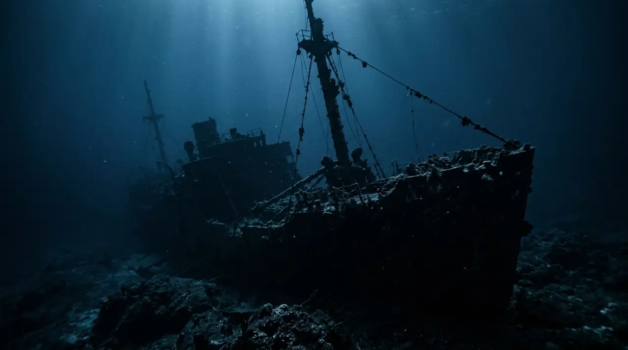
The Hermes sits upright on the sandy seabed southeast of Hamilton in 25 metres of Bermuda's famously clear water, a steel freighter scuttled deliberately in 1985 to create an artificial reef. Four decades later, she has been so thoroughly claimed by the Atlantic that the original vessel is almost secondary to the thriving ecosystem it now supports. This is a wreck dive that doubles as a marine life showcase. I descended the mooring line and the Hermes materialised below, her dark hull standing vertically from the white sand like a building dropped from the sky. The bow railing was draped in soft corals, and a cloud of yellowtail snapper surrounded the forward deck in such numbers that the wreck itself was barely visible through the mass of fish. I swam into the cloud and the snapper parted around me, thousands of golden bodies shifting in synchronised waves before reforming behind me. Dropping to deck level at 15 metres, I peered into the first open hatch and a green moray eel stared back, its jaws rhythmically opening to reveal a row of sharp teeth. Moving aft along the port side, I found morays in almost every opening: one draped over a ventilation pipe, another coiled inside a doorframe, a third sharing a compartment with a massive lobster. The engine room was accessible through a large rectangular hatch, and I descended into the dim interior where a school of Bermuda chub swirled in the confined space, their bodies catching my torch beam. Back on the exterior, a barracuda hovered motionless off the stern, its silvery body pointing into the mild current. Black grouper lurked under the hull overhang, and lionfish occupied several crevices along the hull. The visibility was extraordinary, easily 30 metres, and I could see the entire wreck from bow to stern during my ascent. At the safety stop, I looked down at the Hermes standing in her sand clearing, surrounded by her cloud of fish, a monument to the ocean's power to transform anything we give it into a living reef.
Early access
Plan a dive here
Open the DiveOne planner to sketch a recreational plan before you go. It is a planning assistant, not a dive computer.
Marine life
Dive profile
DEPTH PROFILE
DEPTH PROGRESSION & WAYPOINTS: Hermes Wreck
Location
Frequently asked questions
What is the Hermes wreck?
The Hermes was a 50-metre steel-hulled freighter that was deliberately scuttled in 1985 to create an artificial reef. She sits perfectly upright on a sandy bottom with her deck at about 15 metres and her keel at 25 metres. The vessel was cleaned of hazardous materials before sinking and has been colonised by marine life over four decades, becoming one of Bermuda's most popular wreck dives.
Can I penetrate the wreck?
Yes, the Hermes is one of the best wreck penetration dives in Bermuda for intermediate-level divers. The cargo holds are open and spacious, the engine room is accessible through large hatches, and corridors have clear exit routes. Light penetrates through numerous openings, and silting is minimal due to the sandy bottom. A torch is recommended but the wreck is navigable in ambient light during daytime dives.
How does this compare to the Montana and Constellation wrecks?
The Montana and Constellation are historical shipwrecks lying in shallower water and are more heavily broken up. The Hermes is a modern steel vessel sitting upright and intact, making it better suited for wreck penetration and underwater photography. The Montana and Constellation wrecks offer more historical interest as accidental sinkings. Many divers do all three wrecks during a Bermuda visit.
Reviews
Reviews
No reviews yet
Data Provenance
This profile is compiled from 3 operator submissions and 142 community logs. Key facts (depth, entry) are verified against official hydrographic charts.