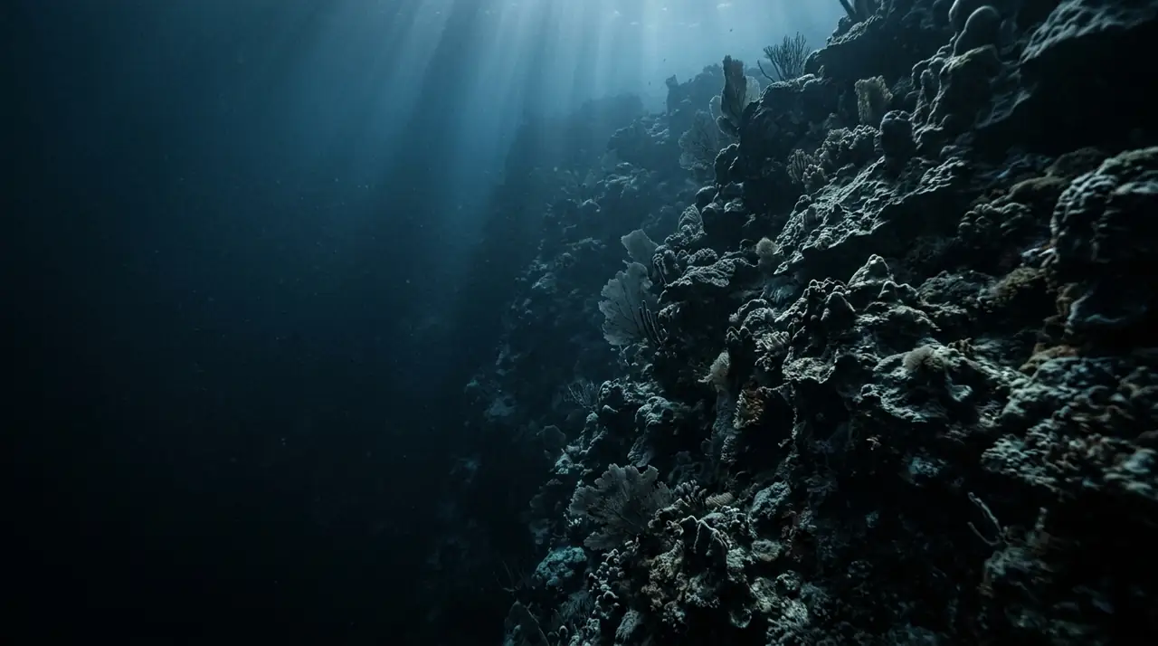
Cane Bay Wall
Overview
Cane Bay Wall in St. Croix is one of the Caribbean's great surprises -- a world-class wall dive that begins from a beach you can drive to. While most legendary wall dives require a long boat ride to a remote reef, Cane Bay delivers the same dramatic vertical drop just a short swim from the sand. Walk into the water from Cane Bay Beach, cross about 100 metres of reef shelf, and suddenly the bottom falls away into the abyss of the Virgin Islands Trough, dropping from 10 metres to over 1,000 metres in a sheer, coral-encrusted vertical face. The reef shelf before the wall is a dive site in its own right. Seahorses cling to gorgonians in the sandy channels, frogfish perch on sponges in perfect camouflage, and yellowhead jawfish hover above their burrows, ducking inside when you approach too closely. Historical anchors from the colonial era -- some dating to the 1600s -- lie half-buried in the coral rubble, their iron shapes now colonized by fire coral and barrel sponges. The wall itself is a spectacle of vertical real estate. Massive plate corals project outward from the face, creating overhangs where nurse sharks and lobster shelter. Tube sponges in every shade of purple and red reach toward the light, and the deeper sections feature wire coral spirals and deep-water sea fans. Spotted eagle rays are frequent visitors, gliding along the wall edge in the gentle current, and hawksbill turtles are spotted on most dives. The beauty of Cane Bay is its flexibility. Open Water divers can enjoy a rewarding dive entirely on the reef shelf and upper wall to 18 metres, while advanced divers can drop deeper along the wall to 30-40 metres where the scenery becomes increasingly dramatic. Night dives from the beach reveal a different world: basket stars unfurl from the corals, octopus hunt across the reef, and bioluminescence sparkles with every fin kick. Visibility averages 20-30 metres, with the best conditions during the dry season from December through April. Cane Bay Wall proves that you do not need a boat, a long journey, or an advanced certification to experience one of the Caribbean's finest wall dives.
Early access
Plan a dive here
Open the DiveOne planner to sketch a recreational plan before you go. It is a planning assistant, not a dive computer.
Marine life
Dive profile
DEPTH PROFILE
DEPTH PROGRESSION & WAYPOINTS: Cane Bay Wall
Location
Near Frederiksted, in the St. Croix region of US Virgin Islands.
Frequently asked questions
Can you shore dive Cane Bay Wall in St. Croix?
Yes, Cane Bay Wall is one of the Caribbean's most famous shore dives. Walk in from Cane Bay Beach and swim about 100 metres to reach the wall's edge. The reef shelf begins at 3-5 metres, the wall lip is at about 10 metres, and the drop-off plunges to over 1,000 metres. This accessibility makes it unique among major wall dives.
What marine life will I see at Cane Bay Wall?
The reef shelf before the wall is rich in macro life including seahorses, frogfish, and yellowhead jawfish. On the wall itself, look for spotted eagle rays, hawksbill turtles, and schooling fish. Historical anchors from the 1600-1700s lie on the shelf, some colonized by corals. Night dives reveal octopus and basket stars.
What certification do I need to dive Cane Bay Wall?
Open Water certification is sufficient to enjoy the reef shelf and upper portions of the wall to 18 metres. Advanced Open Water certification is recommended for exploring the deeper wall between 18 and 40 metres, where larger marine life and more dramatic scenery await. The shore entry and mild currents keep it accessible.
Reviews
Reviews
No reviews yet
Data Provenance
This profile is compiled from 3 operator submissions and 142 community logs. Key facts (depth, entry) are verified against official hydrographic charts.